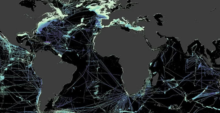
Ocean maps are essential tools that represent the vast, intricate ecosystems and geological features of our planet’s oceans. They provide valuable information for navigation, environmental research, and conservation efforts. As our understanding of the oceans evolves, so do the methods and technologies used to create these vital maps.
Understanding Ocean Topography
One of the primary aspects of ocean maps is their detail on ocean topography—the underwater landscape including mountains, valleys, and plateaus. This topography is crucial for understanding ocean currents, which play significant roles in weather patterns and marine biodiversity. Technologies like sonar and satellite imaging have vastly improved our ability to chart these features accurately. By visualizing these underwater landscapes, researchers can better assess habitats and ecosystems, guiding conservation and management efforts.
Marine Biodiversity and Ecosystem Mapping
Ocean maps also highlight the various ecosystems found beneath the waves, such as coral reefs, kelp forests, and seagrass beds. These areas are often rich in marine biodiversity and are critical for the health of our oceans. Mapping these ecosystems helps scientists monitor their health and informs strategies for protecting endangered species. Additionally, such maps are invaluable for the fishing industry. They guide sustainable practices and support efforts to preserve marine life by illustrating fishing grounds and habitats.
Climate Change and Ocean Mapping
With the ongoing impacts of climate change, ocean mapping has become increasingly important. Rising sea levels, ocean acidification, and changing marine habitats present challenges that can be better addressed with detailed maps. Researchers utilize ocean maps to track changes over time and identify vulnerable areas. These maps are also essential in disaster response, helping communities and governments prepare for storms, flooding, and other climate-related events. Accurate ocean mapping can help drive policy decisions that have a lasting impact on both human and marine communities.
In conclusion, ocean maps are not just tools for navigation but also vital resources for environmental understanding, conservation, and response to climate change. As technology advances, these maps will continue to provide insights that can help protect our oceans and the life they support. If you’re interested in marine science or environmental conservation, take the time to explore the fascinating world of ocean mapping.

