
Introduction: Reading the Ancient Shorelines of Australia
Australia’s modern coastline stretches for more than 34,000 kilometers, yet the shores seen today are only the latest chapter in a much older geological story. Over millions of years, shifting sea levels, tectonic stability, and climatic cycles have repeatedly redrawn the continent’s coastal boundaries. During different prehistoric periods, vast areas that are now underwater were once dry land inhabited by animals and early humans. By studying submerged landscapes, sediment layers, and fossil records, geographers and geologists have reconstructed the remarkable history of Australia’s prehistoric coastlines.
When Australia Was Larger: Lower Sea Levels
During the Ice Ages of the Pleistocene Epoch, enormous volumes of the Earth’s water were locked in continental glaciers. As a result, global sea levels dropped dramatically—sometimes more than 120 meters lower than today. When this occurred, Australia’s coastline expanded far beyond its present limits.
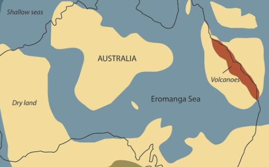
Large portions of what are now continental shelves were exposed as dry plains. Northern Australia was connected to New Guinea, forming the larger landmass known as Sahul. Rivers extended across these now-submerged landscapes, creating valleys and freshwater systems that supported diverse ecosystems.
These ancient coastal plains likely hosted large animals such as giant kangaroos, marsupial lions, and other megafauna that once roamed Australia. The coastline itself lay many kilometers farther out to sea than today’s beaches.
Early Human Migration Along Ancient Shores
The prehistoric coastlines of Australia also played an essential role in human migration. Archaeological evidence suggests that the first people arrived on the continent at least 50,000 to 65,000 years ago. Many researchers believe early populations traveled along coastal routes, relying on marine resources such as fish, shellfish, and seaweed.
Because sea levels were much lower, early settlers may have lived in areas that are now underwater. Ancient campsites, stone tools, and cultural artifacts that once existed on those coastal plains were submerged as sea levels rose after the last Ice Age.
Today, underwater archaeology is beginning to reveal traces of these lost landscapes. Researchers have identified submerged river channels, ancient freshwater lakes, and possible human activity areas along Australia’s continental shelf.
The Great Flooding: Rising Seas After the Ice Age
Around 20,000 years ago, the Earth began warming as the last Ice Age ended. Massive ice sheets melted, releasing enormous quantities of water back into the oceans. This caused global sea levels to rise rapidly.
Between roughly 18,000 and 7,000 years ago, Australia experienced dramatic coastal transformation. Gradually, the expanding oceans flooded the low-lying plains surrounding the continent. Ancient river valleys became estuaries and bays, while former hills and ridges turned into islands.
Regions such as the Gulf of Carpentaria and parts of the Arafura Sea were once land bridges connecting Australia with neighboring regions. As the seas rose, these connections disappeared, isolating Australia and reshaping migration routes for both animals and humans.
Evidence Hidden Beneath the Ocean
Although these prehistoric coastlines are now submerged, scientists can still reconstruct them using several methods. Marine geophysical surveys map the shape of the seafloor, revealing ancient river channels and coastal terraces. Sediment cores taken from the ocean floor provide clues about past environments, including pollen, microfossils, and mineral layers.
In some places, fossil coral reefs also serve as markers of ancient sea levels. Coral grows close to the water’s surface, so fossil reefs preserved at various depths allow researchers to estimate where the ocean once stood.
These techniques allow geographers to recreate detailed maps of Australia’s ancient shorelines and understand how landscapes changed through time.
Lessons for the Future Coastline
The story of Australia’s prehistoric coastlines is not just about the past—it also offers insights into the future. Rising global temperatures today are again causing sea levels to climb, though at a slower pace than during the end of the last Ice Age.
By studying how ancient coastlines responded to changing climates, scientists can better predict how modern coastal environments might evolve in the coming centuries. Understanding these long-term patterns helps coastal planners, environmental scientists, and communities prepare for potential changes to shorelines, ecosystems, and human settlements.
Conclusion
Australia’s prehistoric coastlines reveal a dynamic landscape shaped by climate shifts, sea-level changes, and geological stability. From vast exposed plains during the Ice Ages to the submerged continental shelves of today, the continent’s edges have continually evolved. Through ongoing research in marine geology and archaeology, scientists are gradually uncovering the hidden chapters of Australia’s ancient shores—reminding us that coastlines are never permanent, but always part of an ongoing story written by Earth’s changing climate and oceans.